

Cascade Canal - Oct. '24
return to index
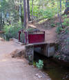
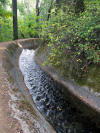
In late October, five of us met in Roseville and then drove to meet Linda B. at a grocery in Nevada City. Then we parked at a neighborhood trailhead at Cascade Canal. We were at elev. 3,200 ft., in the Sierra Nevada foothills gold country. The 1883 canal was used to create hydro power for stamp mills at a mine in nearby Grass Valley.
The hikers were Linda, Diane, Jean, Karen, Barbara Gr., and me. Some of us had not touched base for a few months so it was time to catch up while on a pleasant stroll.
You had to keep an eye out for 'tripping hazards' like protruding stones, or small stumps, less visible in the shade.
Upstream walk -
 |
at the start |
 |
 |
 |
||
 |
gate valve & neighborhood access trail |
 |
dogwood |
 |
||
 |
 |
 |
big leaf maple |
 |
||
 |
 |
canal crosses creek |
 |
After the pipe crossing we walked uphill until we reached the 3.0 mile marker, where we stopped for a water/food break, sitting on a log. Then we turned back.
Downstream walk -
 |
nice arrangement |
 |
sunnier on the walk back |
 |
Karen |
 |
 |
< forest near Nevada City & Barb > |
 |
It was great being in the woods, accompanied by the sight & sound of fast-moving water. We walked 6.5 miles with only minor elevation gain.
There were a few neighborhood access paths to the canal walk, and we saw maybe ten locals out, joggers & dog walkers. We were the only ones parked at the trailhead.
Afterwards all of us stopped at Lake of the Pines on the return drive, to see Rich in his & Linda's recently renovated lakeside home.
Rich seemed happy to see many of his former hiking mates.
.
 |
Jean & Rich |
return to index